Item request has been placed! ×
Item request cannot be made. ×
loading  Processing Request

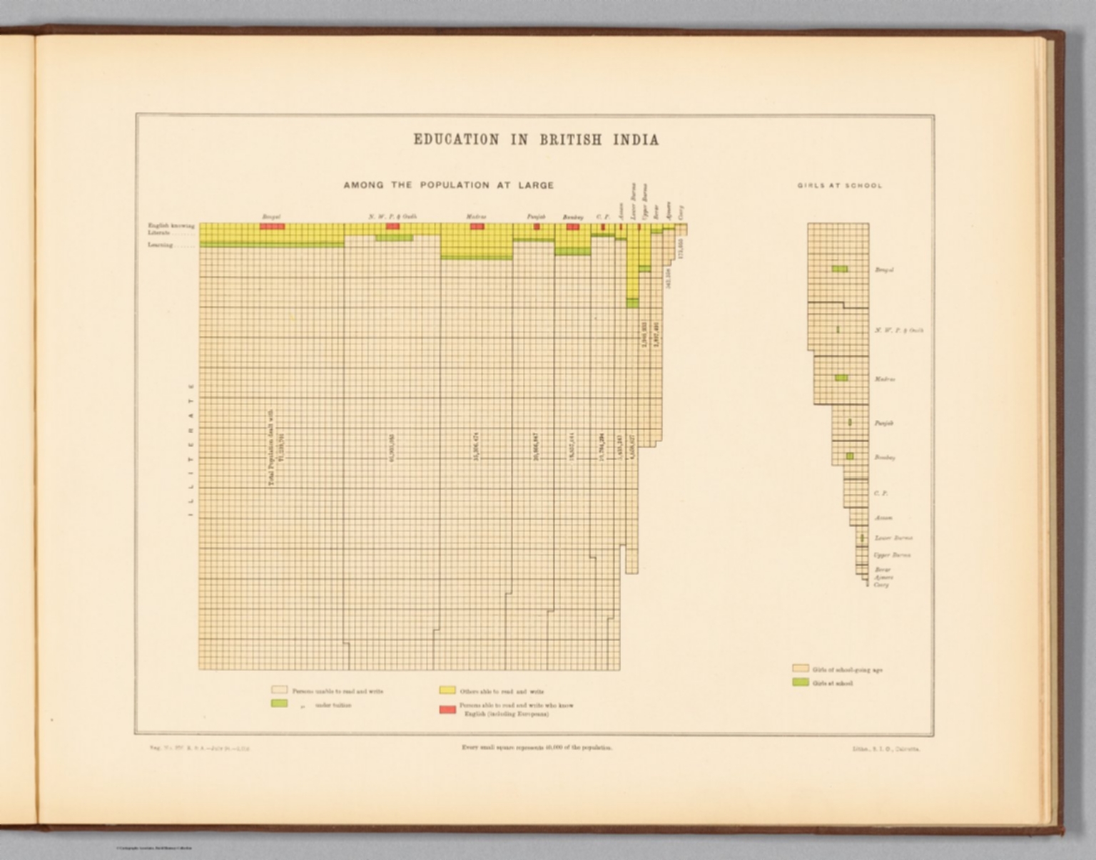
Education in British India : Among the population at large -- Girls at school. Reg. No. 326, R. & A. Dept. - July 94 - 2,016. Litho., S. I. O., Calcutta.
Statistical atlas of India. (Second edition, 1895.) Calcutta: Printed by the Superintendent of Government Printing, India. Maps by the Survey of India Department, 1895.
Education in British India.

Item request has been placed! ×
Item request cannot be made. ×
loading   Processing Request
  • Additional Information
    • Publication Information:
      India. Superintendent of Government Printing, Calcutta, 1895.
    • Publication Date:
      1895
    • Collection:
      David Rumsey Historical Map Collect
    • Subject Terms:
    • Abstract:
      Two colored lithographed diagrams illustrating education in British India, within the total population, as well as girls, and specifying the proportion of literate and illiterate students. Includes a legend and explanatory note. Together, diagrams are 26 x 31 cm, on sheet 34 x 43 cm.
      Statistical atlas of India (second edition) by the Survey of India Department, published in 1895 by the Superintendent of Government Printing, India. Collation: [74] pages, [35] plates with 51 individual maps and 30 individual diagrams. Maps and diagrams illustrate a variety of data described in nineteen chapters. Topics include topography, geology, vegetation, agriculture, commerce, culture, education, migration, and political boundaries, including the distinction between British provinces and native states within India. Maps appear in color and were created by lithographic, zincographic and photolithographic printing processes.
    • Accession Number:
      edsluc.RUMSEY.8.1.358379.90125165